€200 - €300
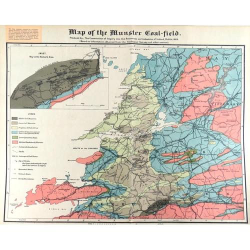
Irish Map: Map of the Munster Coal Field - Produced by the Commission of Inquiry into the Resources and Industries of Ireland, Dublin 1920, coloured lithograph fold. map, published by O'Loughlin, Murphy and Boland Ltd. Dublin 1920, approx. 60cms x 76cms (24" x 30"), unframed. As a map. (1)
Fees apply to the hammer price:
Room and Absentee Bids:
25% inc VAT*
Online and Autobids:
28.075% inc VAT*
+353 (0)56 4441229
[email protected]